
 Geotagging is now quite a popular "exercise" for people use on line album to share their photos. With an additional meta data of geo location, photo album can be organized in a new way.
However the more interesting thing is how this geolocation technology to let people see the world from different aspects and with more details. When I logged on to Flicrk, I could see 38 million photos with location information.
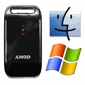 There are not many cameras equipped with geotagging capability. The easiest way to do it is to use a "GPS data logger". I use AGL 3080 since it uses generic USB interface which doesn't require special driver installation to retrieve route data. Once I started my trip, I started route logging. It record travel route automatically in the device.
Then comes the question of how to match geolocation data with the photos you take. The trick is the gps logger logs your travel routes and time simultaneously. Standard digital cameras store some meta data, such as when the photo is taken, settings of the camera, picture resolution, ISO value, and so one, of pictures you take. You need a software to sync both picture and coordinates by time information.
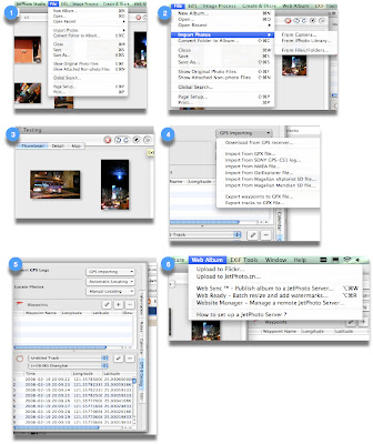
JetPhoto is a free software to allow you do such things. It has a quite well designed mac version. Download and install it to your macbook. After you come back from the trip, just do the following:
- Create a new album with JetPhoto
- Import your picture
- Click on the ">>" icon on the top right of the application
- Select "GPS & Geotag" on the right side of the expanded panel
- Click GPS importing
- Select import from NEMA file. Then it will pop up a window to ask you file location
- Plug in AGL 3080 with USB cable and select the GPS log according to the date it's taken
- Select Automatic locating. It will sycn your photos with location coordinates by time.
- Select Web Album from the tool bar to upload your pictures to Flickr.
Then you are done. You can see the geotagged photo at flicker like
this.

